


When viewing a map of Planet Earth, you might imagine that you are observing all areas of the Earth, but this is not entirely true. The fact is that since the appearance of the celestial body, its structure has changed dramatically over millions of years..
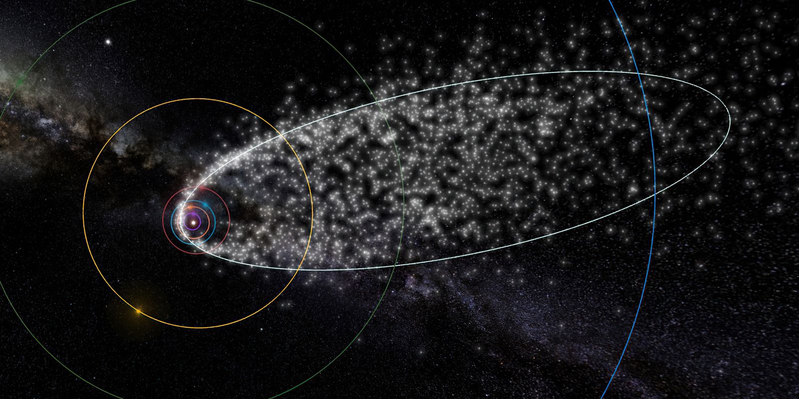
In 2017, a group of geologists uncovered Zealandia, a lost continent with an area of 4.9 million square kilometres, nearly six times the size of Madagascar. The discovery does not refer to New Zealand, but rather to land “lost” due to its submersion in the Pacific Ocean – despite this, it is located around New Zealand.
Zealandia is not the only continent that has disappeared from Earth. Geologists point out that some areas of the world are also under water and we know little about them. When it is stated that they “disappeared”, it is not quite literal, but humanity does not know exactly where they are.
“It's very difficult to make discoveries when everything is two kilometers underwater, and the layers we need to sample are also 500 meters (about 1,640 feet) below the seafloor. It's really difficult to go out and explore a continent like this,” said Robert Sutherland. “It takes a lot of time, money, and effort to go out on ships and map areas,” says Dr., associate professor of geophysics and tectonics at Victoria University of Wellington in New Zealand.
To help you understand how the continent disappeared, TecMundo has collected information from geologists, experts in the field and other scientists. paying off!
Lost continents
The researchers explain that most people think of continents through their geographical shape, but some of them are much more than just the shape shown on the world map. In fact, geology plays a more important role in explaining the continent; That is, it also includes rocks located below sea level.
The “disappearance” of some of these regions can be explained by the way the continental crust undergoes major changes over thousands of years.Consequently, they end up submerged in water – in other words, these areas “dive” under the oceans due to the movements of tectonic plates.
Although Greater Adria and Argoland are considered lost continents, some scholars disagree. They argue that these areas were fragmented before they were submerged.source: Utrecht University
So they don't disappear, But they end up being “dragged” to the bottom of the sea and are no longer easy to find by science, like Zealandia..
Fortunately, advances in technology have enabled geologists to use computer models to gather more information and provide maps of these lost areas. Currently, Zealandia is the best mapped lost continent, but it is by no means the only one.
New Zealand
Zealandia is the lost continent with the best maps yet. As the geologist who led the research in the area, Nick Mortimer, explains, after years of study, research scientists began to realize that the rocks below sea level are part of a larger terrestrial structure.
“Mapping is an achievement we're proud of. But it's just the beginning of understanding. The most interesting questions in science are when, how and why. These are the things that will be covered later,” said Mortimer, having researched Zealandia for more than 30 years.
Adria the Great
a Greater Adria was part of a region in North Africa that separated about 240 million years ago, during the Triassic. —It was part of the supercontinent Gondwana. For a long time, the lost continent remained under tropical seas, until it began to slide under Europa and enter the planet's mantle.
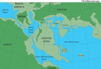 The illustration shows what the continent of Greater Adria looked like 140 million years ago.source: Utrecht University
After extensive research, geologists found samples of rocks belonging to Greater Adria, and were thus able to map part of this area. Some parts of the ancient continent reach a depth of 1,500 kilometers.
Argolandia
The continent of Argolandia formed about 155 million years ago, breaking off from the western region of present-day Australia – the sliver of land was 5,000 kilometers long and was also part of Gondwana.
Researchers have found evidence of its existence from fossil samples, rocks and mountain ranges. also Traces have been found on the Argo Abyssal Plain, deep in the ocean off the northwest coast of Australia.
Did you like the content? So, stay tuned for more curiosities about continents and supercontinents here at TecMundo. If you like, take the opportunity to understand how researchers created a definitive map of Earth's tectonic plates.

“Hardcore beer fanatic. Falls down a lot. Professional coffee fan. Music ninja.”
More Stories
A highly contagious virus fills hospitals in Brazil
Do we all feel that time passes in the same way?
What is the ideal running time to lose belly fat?