NOAA
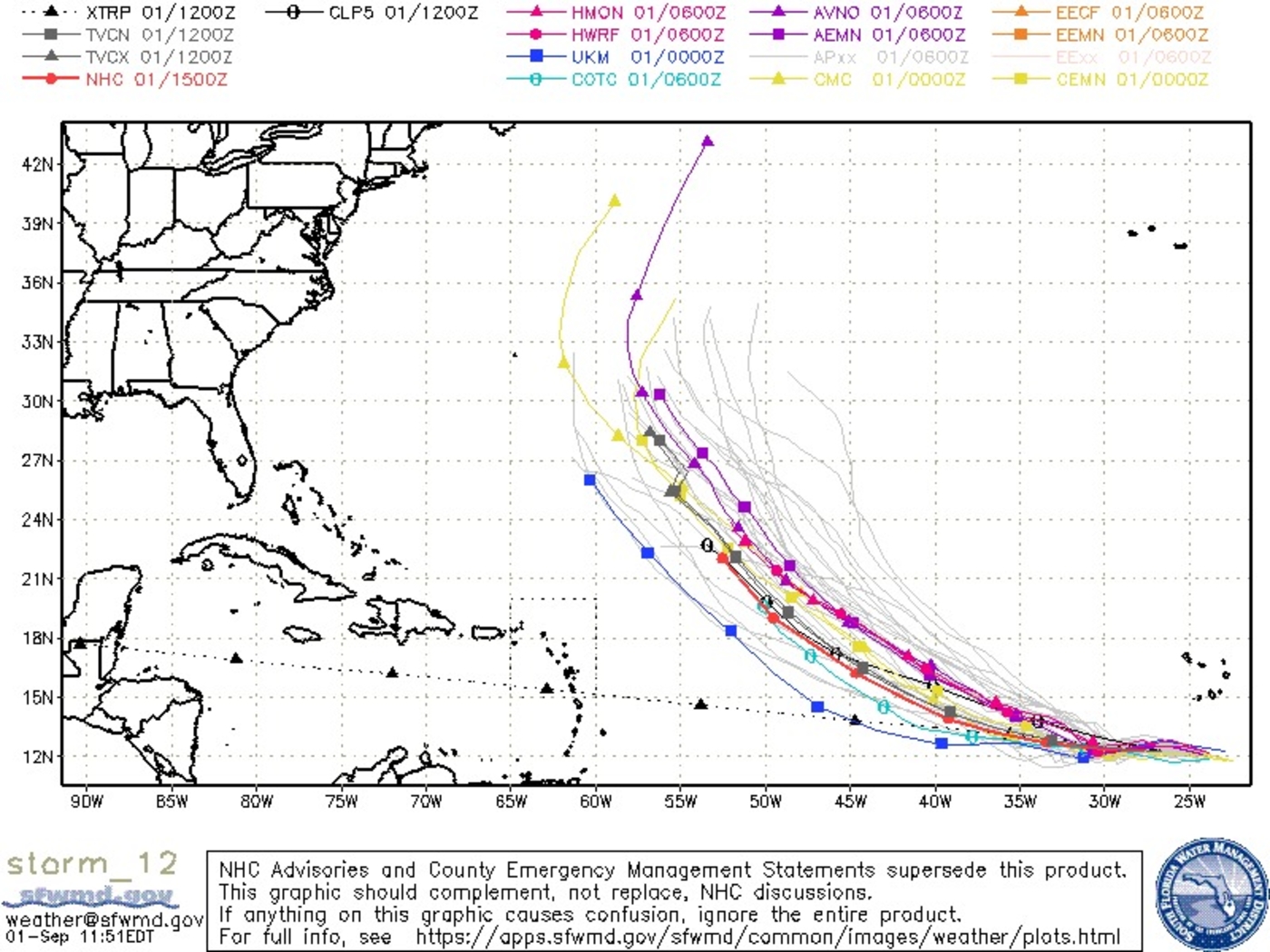
a week after devastating hurricane Third Ida hit the United States, Another severe hurricane (categories 3 to 5) operating in the North Atlantic Ocean. It’s Larry. The good news is that unlike Ida, Larry goes out into open water far from the coast and shouldn’t pose a danger to densely populated areas. However, the storm is expected to pass dangerously close to Bermuda.
Larry is currently a Category 3 hurricane and is expected to strengthen to Category 4 early this week. Late Sunday afternoon, the hurricane was located at 20.1°N, 50.2°W with sustained winds of approximately 180 km/h and a minimum central atmospheric pressure of 955 hPa.
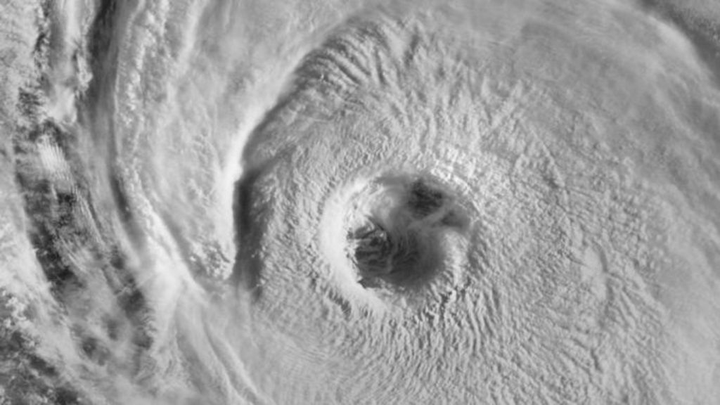
This weekend, the structure of the storm caught the attention of meteorologists, as it was very focused and at different times with well-defined eyes. This Sunday, part of the eye wall has become less organized with a larger cut pattern.
3D Infrared Satellite Ring of Big Hurricane # larry. This is a large storm with hurricane-force winds extending up to 45 miles from the center and tropical storm-force winds extending up to 175 miles.
Courtesy Ring Tweet embed Application pic.twitter.com/HV8Aw62vGc
– Colin GrossWx September 5, 2021
Here is a charming look at the great hurricane # larryThis morning’s set the past hour, using GOES-16’s 1-minute visuals. pic.twitter.com/uByfKuUV3C
– NWS Corpus Christi (@NWSCorpus) September 5, 2021
sunrise on big # larry pic.twitter.com/9EUgGxIifT
– StuOstro September 5, 2021
The storm is expected to generate a large wave with large waves hitting the Lesser Antilles and then spreading west to parts of the Greater Antilles, the Bahamas and Bermuda.
[8:30pm EDT 9/4/2021] Hurricane Larry – Peak seas are currently near 42 feet and will reach 48 feet by Monday. Big swell up to the Leeward Islands tonight. pic.twitter.com/MrPJavMGGK
– NHC_TAFB (NHC_TAFB) September 5, 2021
Large waves are likely to hit the eastern coast of the United States during the week, and numerical models indicate that the Lari Swell will reach the coasts of Para, Amapa and Maranhão in Brazil, with increased sea emotion.
Models indicate waves up to 15 meters near the center of the storm, but we emphasize that if the swell reached the northern coast of Brazil, the sea height would not be significant compared to other regions.
The 2021 Atlantic hurricane season has already generated 38 storm days. After just six years of satellite life (from 1966 onwards) they had more storm days running through September 4th: 1995, 1996, 2005, 2008, 2012 and 2020.
Larry is the third severe hurricane of the 2021 Atlantic season. Only three other Atlantic seasons have had 3 hurricanes with maximum winds approaching 200 km/h as of September 4: 1933, 2005, and 2008.
Subscribe to our free newsletter to get news and alerts

“Music fanatic. Professional problem solver. Reader. Award-winning tv ninja.”


:strip_icc()/i.s3.glbimg.com/v1/AUTH_59edd422c0c84a879bd37670ae4f538a/internal_photos/bs/2023/A/A/RegC4eSG2LRB27pMYWEg/1910-bdbr-telemkt0303-extra.01-frame-2769.jpeg)


More Stories
He tried to walk to the World Cup in Qatar, and ended up in a scary prison in Iran
The “Gate of Hell” in Turkmenistan was created by human error; The gap reaches more than 400 degrees – the world
Jalisi mocks the TikTok siege in the United States: “Defenders of freedom?”